The Adventure Company

5 Places to cross the Continental Divide in Colorado

continental divide colorado

.

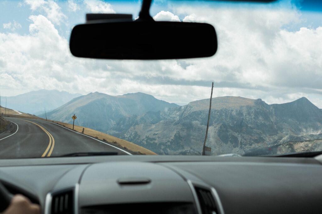
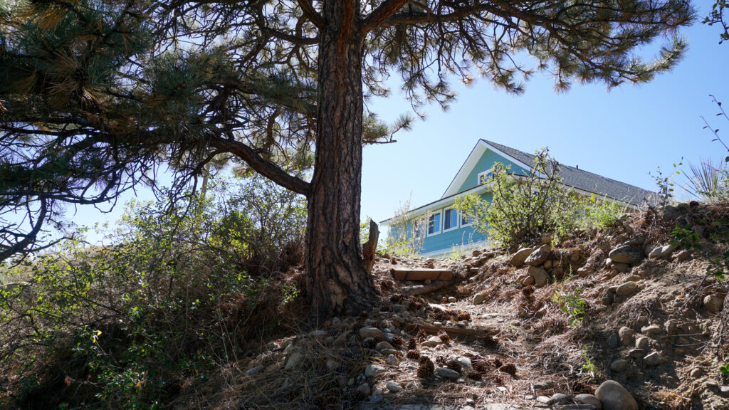
When traveling through Colorado you cannot avoid hearing about the beauty of the Continental Divide. Continental Divide points of interests are great spots to stop and take pictures while soaking in the scenery on a Rocky Mountain road trip.

When checking with locals and visitors, we discovered a lot of confusion regarding what the Continental Divide actually is.

The History of the Continental Divide

The Continental Divide has shaped North America’s landscapes, cultures, and travel routes for millions of years.

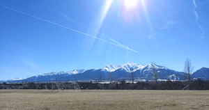
The Rocky Mountains, which form much of the Great Divide, began rising over 70 million years ago due to tectonic activity, directing rivers toward either the Pacific or Atlantic Oceans. Indigenous tribes like the Ute and Arapaho used the divide as a natural boundary and travel route for hunting and trade.

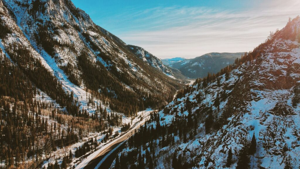
In the early 1800s, Lewis and Clark crossed the divide at Lemhi Pass, Montana, marking a major milestone in westward exploration. As settlers moved west, the divide presented a significant challenge for travel and trade. By the late 19th century, railroads and roads made crossing the divide easier. The Transcontinental Railroad provided a faster route, while modern highways like I-70 and Trail Ridge Road turned it into a scenic attraction.

Today, the Continental Divide is an iconic landmark, drawing hikers, road-trippers, and outdoor enthusiasts eager to experience its breathtaking landscapes and rich history.

Understanding the Continental Divide

A continental divide is a watershed boundary where the drainage basin on one side feeds into one ocean or sea, while the other side feeds into a different ocean or sea.

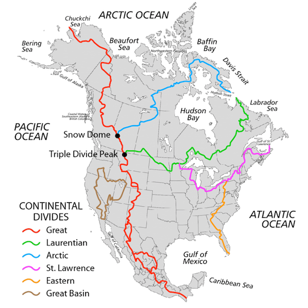
 North America’s Continental Divides – The Great Divide

The most famous Continental Divide of the Americas is also called the Great Divide. It separates the watersheds of the Pacific Ocean from those of the Atlantic Ocean.

It runs from Alaska, through western Canada along the crest of the Rocky Mountains to New Mexico. From there, it follows the crest of Mexico’s Sierra Madre Occidental and extends to the tip of South America.

However, this isn’t North America’s only continental divide, there is also the Northern Continental Divide, the Eastern Continental Divide, the Saint Lawrence River Divide, the Great Basin and the Laurentian River Divide.

Some towns you can’t miss along the way include Leadville, Aspen, Buena Vista, Estes Park, and Breckenridge!

.See the map below to learn more about America’s Continental Divides.

map-continental-divides-north-america

.

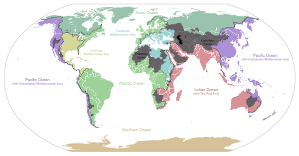
Continental Divides of the World

Depending on your definition of ocean, Eurasia, Africa, Australia and Antarctica have multiple divides.
The map below shows drainage of the major oceans and seas of the world…

Ocean Drainage World Map
Source: Wikimedia Commons

.

Myths and Misconceptions About the Continental Divide

The Continental Divide is one of North America’s most famous natural landmarks, but it’s also surrounded by myths. From water flow to weather patterns, let’s set the record straight on some of the most common misconceptions.

Water Swirls in a Different Direction at the Continental Divide

False. Despite the legend, standing on one side of the Continental Divide won’t make water swirl differently than on the other. The Coriolis effect, which influences massive weather patterns, is far too weak to impact water in sinks, toilets, or small streams. Instead, factors like bowl shape, movement, and pressure determine which way water drains—not geography.

The Continental Divide Is a Single, Unbroken Line

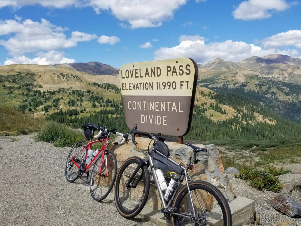
False. The Great Divide is just one of several continental divides in North America. Other significant divides, like the Northern Divide, Eastern Divide, and Laurentian Divide, also play a role in directing water to different oceans and basins. In Colorado, the Great Divide follows the Rocky Mountains, separating waters that flow toward the Pacific and Atlantic Oceans.

Wind Always Changes Direction at the Continental Divide

False. While it’s true that high-altitude passes along the divide, like Loveland Pass and Independence Pass, experience unpredictable winds, the divide itself doesn’t control wind patterns. Wind is shaped by global atmospheric circulation, terrain, and local weather systems, not an invisible force at the Continental Divide.

It’s Always Colder on One Side of the Continental Divide

False. The Continental Divide itself doesn’t dictate temperature, but it does influence regional weather patterns. The Western Slope of Colorado tends to be drier due to the rain shadow effect caused by the Rocky Mountains, while the Eastern Slope gets more moisture and precipitation. However, temperature differences are primarily due to altitude, seasonal changes, and regional climate patterns—not just the divide.

The Continental Divide Causes Earthquakes

False. While the Rocky Mountains were shaped by tectonic activity, the Continental Divide is not a fault line and doesn’t cause earthquakes. Most seismic activity in the United States is linked to active fault zones like the San Andreas Fault in California or the Wasatch Fault in Utah.

You Can See the Continental Divide from Space

Partly true. The Rocky Mountains, which form much of the Great Divide, are visible from space. However, the divide itself is not a distinct line but rather a natural watershed boundary that follows ridges and peaks. While astronauts can spot the mountain range, the divide is not a visible landmark like a road or a river.

Where to visit the Great Continental Divide in Colorado...

.1. Hike the Continental Divide Scenic Trail

The entire Continental Divide Trail is 3,100 Miles long and is one of the most significant trail systems in the world.  However, you can also explore parts of it. Learn all about the Continental Divide Trail (CDT) trails HERE.

.2. Take a drive on Trail Ridge Road

Trail Ridge Road in Rocky Mountain National Park is the highest continuous paved road in North America, climbing to 12,183 feet. The route offers unmatched views of the Continental Divide, scenic overlooks like Milner Pass, and wildlife sightings, including elk, bighorn sheep, and marmots. This spectacular mountain road is only open from late May to October due to heavy winter snowfall.

continental divide colorado
Source Unsplash

3. Skip I-70 for the legendary drive over Loveland Pass

For a more scenic alternative to I-70’s Eisenhower Tunnel, Loveland Pass at 11,990 feet provides breathtaking panoramic views of the Continental Divide. It’s a popular spot for photos and hiking, particularly at sunrise and sunset. In winter, the pass is a gateway to backcountry skiing and snowboarding, though snow and ice can make conditions challenging.

continental divide colorado
Source Unsplash

4. Visit the Continental Divide on Cottonwood Pass

This drive is close to Buena Vista. The road is paved on the Buena Vista side and is dirt on the other side towards Crested Butte. Enjoy the fantastic views from the top! Cottonwood pass is definitely the prettiest and best way to drive to Crested Butte and experience the Great Divide. Don’t forget to stretch your legs and come whitewater rafting when you’re in Buena Vista! 

continental divide colorado
Source Unsplash

5. Independence Pass

Another very scenic drive from Aspen to Leadville with spectacular mountain views spanning from Buena Vista to Aspen. Keep your eyes peeled for wildlife (and Lance Armstrong!) on the switchback roads – they like to roam at these higher elevations. 

continental divide colorado
Source Unsplash

3 Places to Stand on the Continental Divide Near Breckenridge

If you’re based in or visiting Breckenridge, here are three great spots where you can stand right on the Continental Divide in Colorado:

Hoosier Pass

Just 20 minutes south of Breckenridge, Hoosier Pass sits at 11,542 feet and offers stunning views of the Mosquito Range. A parking area at the summit makes it an easy stop, and you can walk a short distance to stand directly on the divide. It’s one of the most accessible points near town.

Boreas Pass

This scenic route east of Breckenridge was once a railroad corridor. Today, you can drive or bike to the summit of Boreas Pass (11,482 feet), where you’ll cross the divide and enjoy wide-open views of alpine meadows and distant peaks.

Georgia Pass

Georgia Pass is more rugged, requiring a high-clearance vehicle, mountain bike, or hike to access. It’s one of the lesser-known spots on the Colorado Continental Divide, but the views at 11,598 feet are worth the effort for those seeking a more remote experience.

When you find yourself road-tripping through Central Colorado, be sure to come whitewater rafting with the experts at The Adventure Company through Browns Canyon in Buena Vista. Recently designated a National Monument, Browns Canyon is a stunning high desert class III stretch of the Arkansas River. 

browns canyon whitewater rafting

Don’t miss your chance to stay at A Riverhouse Lodge, a stunning lodge nestled on the Arkansas River with breathtaking views of the Collegiate Peaks and the Arkansas River from each room. Get a special discount on lodging when you raft with The Adventure Company!

a riverhouse lodge hotels in buena vista co

Frequently Asked Questions

It follows the crest of the Rocky Mountains from the Wyoming border to New Mexico, passing near towns like Breckenridge, Buena Vista, and Aspen.

Breckenridge is located just west of the divide, making it a great base for exploring nearby passes and trails.

Trail Ridge Road, Loveland Pass, and Cottonwood Pass offer some of the most scenic and accessible views of the divide.

It’s a natural boundary that splits the continent’s river systems, sending water to either the Pacific or Atlantic.

Yes! At Milner Pass, Loveland Pass, and other roadside spots, you can literally stand with one foot in each watershed.

It shapes how water flows across North America and defines major geographic regions.

You can see it from multiple scenic drives and hikes, including Trail Ridge Road, Cottonwood Pass, and the Continental Divide Trail.

Yes. In Colorado, the Continental Divide follows the spine of the Rocky Mountains. This natural boundary runs along high mountain ridges and peaks, directing water west to the Pacific and east to the Atlantic. So, when you're hiking or driving through the Rockies—especially near places like Trail Ridge Road or Loveland Pass—you’re often crossing the Great Divide itself.

The Continental Divide Trail (CDT) is primarily a hiking and backpacking trail, not open to vehicles. However, many scenic drives—including Trail Ridge Road, Cottonwood Pass, and Independence Pass—cross the Continental Divide in Colorado and offer similar panoramic views. You can explore the divide by car on these routes while staying close to the CDT.

The nearest point of the Continental Divide is about 60 miles west of Denver. Popular spots like Loveland Pass and Berthoud Pass are within a 90-minute drive, depending on traffic. These locations offer scenic overlooks and hiking access right on the divide, making them perfect for a day trip from the city.

The Continental Divide is also known as the Great Divide or Continental Divide of the Americas. It’s the most well-known of several continental divides in North America, and it marks the point where river systems split toward either the Pacific or Atlantic Oceans. In Colorado, it's a defining geographic feature of the state’s landscape.

Share the Adventure

Scroll to Top