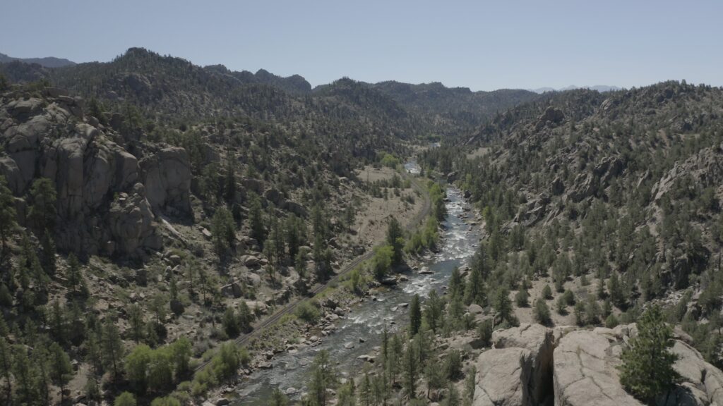
Less than a million years ago, three glaciers formed a nearly 700′ ice dam near what is now Granite, Colorado just north of Buena Vista. Blocking the Arkansas River, it formed a 600′ deep lake spanning 12 miles north towards Leadville (the headwaters of the river).
When the ice dam broke, it cased catastrophic glacial flooding and deposited a s layer of boulders as big as 60′ thick for the next 10 miles downstream. The floods were so intense they left 4′ boulder up to 160′ up the valley walls. These floods are thought to be 10,000 and 16,000 years ago.
The Arkansas Valley is ‘chalked’ full of geological history. You can drive through time and see the difference between Leadville and Buena Vista. You can almost see where the glacial ice dams started to form the bouldery landscape of Buena Vista.
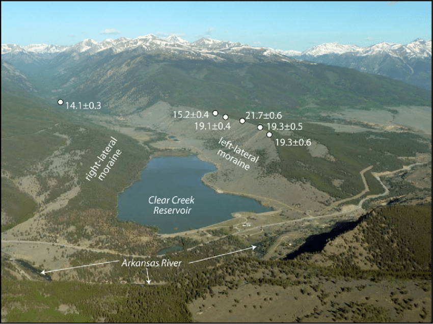
Clear Creek Reservoir, just south of the town of Granite and north of Buena Vista, is surrounded by two lateral moraines. A lateral moraine is a pile of glacially transported rocks and debris that are dropped by the glacier as it melts. Click here for more information and diagrams on the glacial history of Clear Creek Reservoir and the Arkansas Valley.
Clear Creek is an easily accessed but remote feeling reservoir where you can take the inflatable kayaks and hangout in the sun. Maybe take the hardshell kayak and practice your roll? Take the dog and enjoy the big mountains up against the swimming hole in the Colorado summer sun.
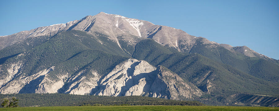
If you’ve visited Buena Vista, Colorado you’ve seen the exposed cliff face of Mt. Princeton, otherwise known as the Chalk Cliffs. These cliffs are made of a soft clay mineral known as kaolinite which is formed from the natural hot springs, percolating through the cracks in the mountain of Mt. Princeton. The geothermal activity has caused the exposed cliffside known as Chalk Cliffs. This natural wonder isn’t glacially formed, but we just wanted to share the geology of the area!
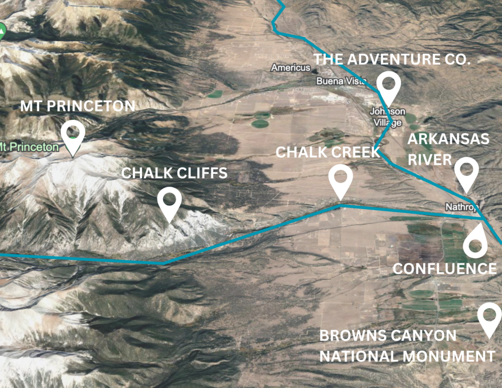
Chalk Creek runs down towards, and into, the Arkansas River. You can see the mineral-rich ‘chalky’ confluence near Nathrop when you raft through Browns Canyon National Monument. The chalky appearance of the river is from the kaolinite mineral in the geothermal formed Chalk Cliffs.
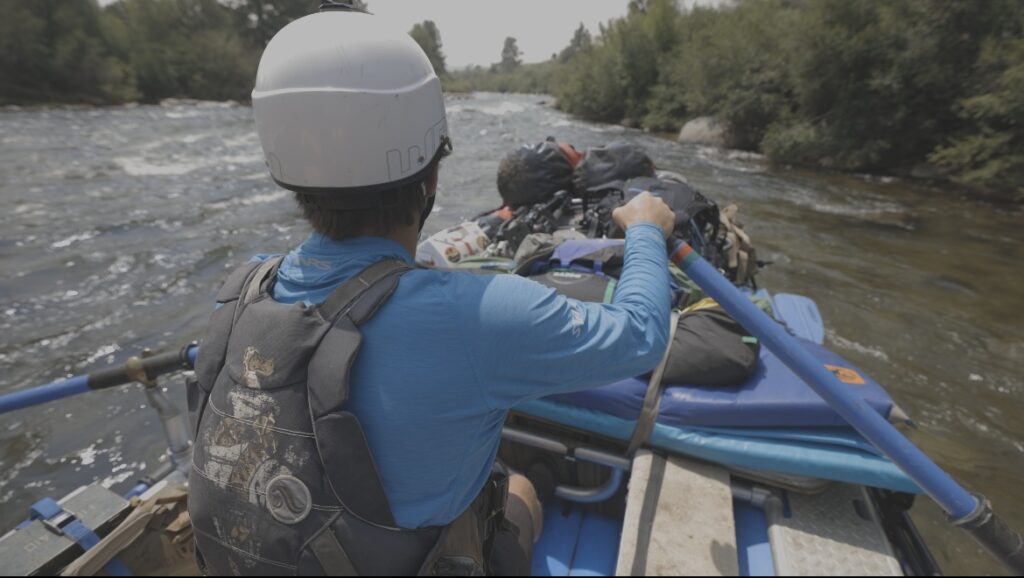
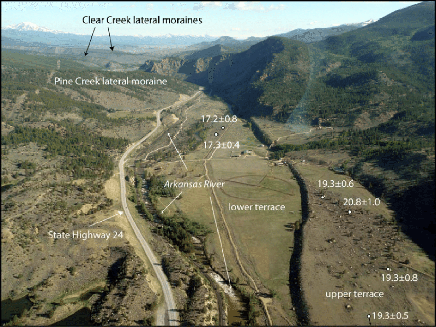
For an in-depth look at the glacial history of the Sawatch Range and Arkansas Valley, keep reading here. When you come whitewater rafting through Browns Canyon with The Adventure Company, your guides will be sure to point out geological phenomenons both on and off the river!